Ad Unit

Tuesday, September 2, 2014

Shri Amarnath Yatra 2014

Shri Amarnath Yatra 2014

One of the Holy trinity, Lord Shiva is a living God. The most ancient and sacred book of India, the "Rig Veda" evokes his presence in its hymns. Vedic myths, ritual and even astronomytestify to his existence from the dawn of time.

Lord Shiva is known to have made his adobe in the Himalayas. He built no house nor shelter, not for himself or his consort Goddess Parvati. He was an ascetic, and yet married; He could be both
for "He is the god sporting in the forest or taking his ease on a cloud."

Situated in a narrow gorge at the farther and pf Lidder valley, Shri Amarnathji Cave Shrine stands
at 3,888 m and is 45 km from Pahalgam and 141 km from Srinagar. Though the origial pilgrimage subscribes that the yatra be undertaken from Srinagar, the more common practice is to be begin the
journey from Pahalgam, and cover the distance to Shri Amarnathji and back in four or five days. Pahalgam is 96 km from Srinagar. In recent times the Baltal route ia Sonamarg has also become very popular because of it's short distance track to the Holy Cave of Shri Amarnathji.

Shri Amarnathji Holy Cave

Amarnath cave is a Hindu shrine located in Jammu and Kashmir, India. It is dedicated to Shiva. The cave is surrounded by snowy mountains. The cave itself is covered with snow most of the year expect for a short time period in the summer when it is open for pilgrims. Thousands of
Hindu devotees make an annual mountainous terrain to see an ice stalagmite formed inside the cave.

The Linga

Inside the 40 m high Amarnath cave, the stalagmite is formed due to freezing of water drops that fall from the roof of the cave on to the floor and grows up vertically from the cave floor. It is considered to be a Shiva Linga bu Hindus.

Ice Lingam at Amarnath Cave
The cave waxes during May to August, as snow melts in the Himalayas above the cave and the
resultant water seeps into the rocks that form the cave and gradually wanes thereafter. As per the
religious beliefs, it has been claimed that the lingam grows and shrinks with the phases of the moon reaching it's height during the summer festival, although there is no scientific evidence for the belief.

According to Hindu legend, this is the cave where Shiva explained the secret of life and eternity to
his divine consort, Parvati. Two other ice formations represent Parvati and Shiva's son, Ganesha.

The main pupose of the annual pilgrimage to the cave is worship of the ice stalagmite Lingam.
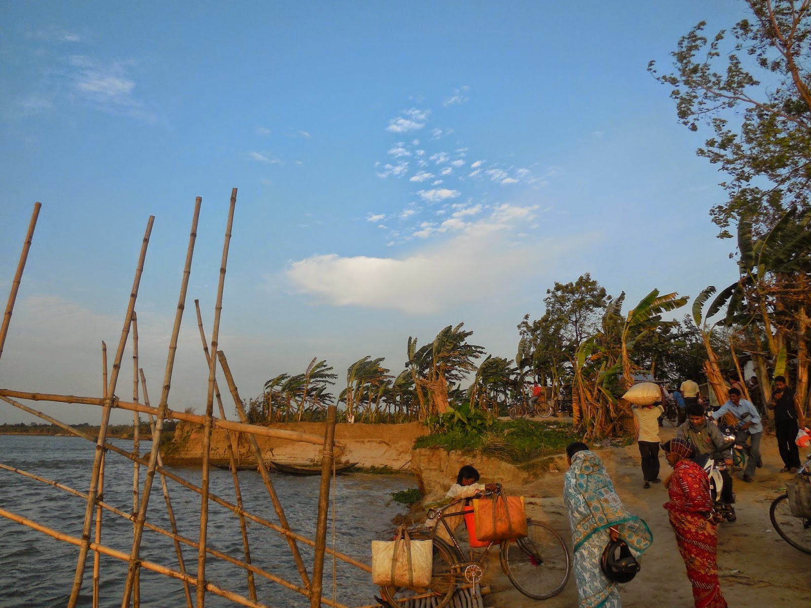
Amarrnathji Yatra  

On way to Amarnath cave
The temple is a popular yatra destination for Hindus. In 2011 it received about 634,000 persons, the highest number for the site, in 2014 most about 12,000 persons registered for this yatra and
about 3.2 lakh pilgrims have paid obeisance at the holy ice lingum of Lord Shiva. The number was
622,000 in 2012 and 350,000 in 2013. Pilgrims visit the holy site during the 45-day season around
the festival of Shravani Mela in July-August, coinciding with the Hindu holy month of Shraavana.

Amarnath pilgrims en route the holy shrine
The beginning of the annual pilgrimage, is called Amarnath Yatra is marked by "pratham pujan" to
invoke the blessings of Shri Amarnathji.

Amarnath Yatra Camp

Saturday, August 30, 2014

Shri Mata Vaishno Devi Shreedhar Darshan Yatra 2014

Shri Mata Vaishnodevi Shreedhar


In Hinduism, Vaishno Devi, also known as Mata rani and Vaishnavi, is a manifestation of 
the Mother Goddess or Durga. The words "maa" and "mata" are commonly used in India 
for "mother", and thus are often used in connection with Vaishno Devi.

Mata Vaishno Devi Shreedhar
The words "mandir" and "mandira" are commonly used in India for "Hindu Temple", and so 
these used in connection with Vaishno Devi. Vaishno Devi Mandir is one of the holy hindu 
temples dedicated to Shakti, located at the Trikuta mountains within the indian state of Jammu 
and Kashmir.


Shri Mata Vaishno Devi Shreedhar Yatra 2014


Maa Vaishno Devi temple can be reached from Katra. katra is a small but bustling town around 
45 k.m from Jammu. From Katra, after getting the "Yatra Parchi" (Journey Slip) at Banganga 
point for darshan, devotees can proceed to Bhavan.

Entrance gate where the Yatra begins (Baann Ganga)
The way to Bhavan is steep and requires a long walk uphill from Katra. Alternatively poines 
and palanquins are alos available. Helicopter service can also be taken for a large part of the
trip. The Trust offers comfortable stay for pilgrims. Katra is at an altitude of about 2500 feet
(about 762 meters); Banganga is at an altitude of about 2800 feet (863 meters); Bhavan is at
the altitude of about 6200 feet (about 1900 meters); and, the distance from Katra to Bhavan
is about 13 km.

Vaishno Devi Bhavan
Indian Railways will start rail services up to Katra from a date prior to 9th July 2014 when
Union Rail Budget of 2014-15 is to be presented in the Parliament (Tentative). They are in
communication with the Jammu and Kashmir Goverment to integrate permit slips for Vaishno
Devi Darshan with the train ticket. The passenger can get permit slips while booking the train
ticket.


Vaishno Devi Bhavan long view look (way to the temple)


Thursday, August 28, 2014

Wagah Border Ceremony

Wagah Border Ceremony

The Wagah border closing "lowering of the flags" ceremony or The Beating Retreat ceremony
is a daily military practice that the security forces of India (Border Security Force) and Pakistan
(Pakistan Rangers) have jointly followed since 1959.


Everyday of the year, just before sunset, a flag lowering ceremony takes place at the Wagah -
Border between India and Pakistan. The Wagah Border ceremony is a popular tourist attraction and and side trip from Amritsar, in Punjab India.


Wagah Border Flag Hosting Ceremony

The ceremony lasts for around 45 minutes in total. It starts with high patriotic spirits from sides of the border. Soldiers march towards the gate at the border, which is thrown open they reach there.
The soldiers salute each other and start lowering the flag.

Wagah Border unity symbol
The flags are lowered at the same time. The soldiers retrieve and fold the flags, the gate slams 
shut, and a trumpet sounds the end of the ceremony. The soldiers then return with their country's respective flag.

Wagah Border flag lowering ceremony
 
This ceremony has been flimed and broadcast by Michael Palin for one of his television around
the world travel programs; he described it as a display of "carefully choreographed contempt."

For more information go to : wiki/Wagah_border_ceremony

The Gate of Pakistan
Watch our full Wagah border ceremony photo collection go to the next page....

Wednesday, August 27, 2014

Jallianwala Bagh

Jallianwala Bagh


Jallianwala Bagh is a public garden in Amritsar in the Punjab state of India, and houses a memorial
of national importance, established in 1951 to commemorate the massacre by British occupying forces of peaceful celebrators on the occasion of the Punjabi New Year on April 13, 1919 in the Jallianwala Bagh Massacre. Colonial British Raj sources identified 379 fatalities and estimated 
about 1100 wounded. Civil Surgeon Dr. Smith indicated that were 1.526 casualties. The true figures of fatalities are unknown, but are likely to be many times higher than the official figure
of 379.

Jallianwala Bagh memorial, Amritsar

The 6.5 - acre (26,000 m) garden site of the massacre is located in the vicinity of Golden temple complex, the holiest shrine of Sikhism.

The memorial is managed by the Jallianwala Bagh Nation Memorial Trust, which was established as per the Jallianwala Bagh National memorial Act passed byt he Goverment of India in 1951.

For more information go to : wiki/Jallianwala_Bagh

Narrow passage to Jallianwala Bagh Garden through which the shooting was conducted

Loop of death (People jumped into this well for saving their life)

From here 1600 rounds of bullets were fired by troops on 20,000 innocent people


Bullet marks on the walls of the park premises


Bullet marks description written broad

For more information about Jallianwala Bagh massacre go to : wiki/Jallianwala_Bagh_massacre


Monday, August 25, 2014

Kargil War Memorial

Kargil War


The Kargil War also known as the Kargil conflict, was an armed conflict between India and Pakistan that look place between May and July 1999 in the Kargil district of Kashmir and elsewhere along the Long of
Control (LOC). The conflict is also referred to as Operation Vijay, which was the name of the Indian operation to clear the Kargil sector.

Kargil War Heroes 

Kargil War winning celebration of Indian Army

Kargil War Date : May - July 1999
Location : Kargil district, Kashmir
Result of the War : Pakistani military retreat; India regains control of occupied territory.

For more information about the war go to :  wiki/Kargil_War


Kargil War Memorial


Kargil war memorial, built by the Indian army following the war with neighboring Pakistan in the late nineties is frequented by travelers plying the highway connecting Srinagar to Leh. The memorial houses some of the major sequence of events that happened during the course of the war along with details of the Indian army 
personnel, who sacrificed their lives in the process of recapturing some of the peaks occupied by the army
of Pakistan; like the Tiger Hill and Tololong.

 The memorial has a memento shop, selling hats, T-shirts, coffee mugs etc. But the main attraction of the whole memorial is the Sandstone wall, in the open, which has the names of all the Indian army personnel, who laid their lives during the Kargil war. Visitors to memorial can also see from there, some of the peaks that the Indian army captrued back from Pakistan.

For more information about the Kargil war memorials go to : /kargil-war-memorial


The Gate of Kargil War Memorial

OP Rato and OP Vijay Graveyard

OP Rato and OP Vijay Graveyard


The Fighter Plane of Indian Army

The Bridge was try to broken by Pakistani army at time of Kargil war

Kargil War Memorial Ground Premises 

The Giant Indian Flag at the Memorial

For watching for photographs of Kargil War Memorial go to next page or read more...

Saturday, August 23, 2014

Dal Lake (Srinagar)

Dal Lake


Dal Lake is a lake in Srinagar the summer capital of Jammu and Kashmir. The urban lake, which is the second largest in the state, is integral to tourism and recreation in kashmir and is name the "Jewel in the crown of Kashmir" or "Srinagar's Jewel". The lake is also important source for commercial operations
in fishing and water plant harvesting.

Location : Srinagar, Jammu and Kashmir, India


Dal Lake, Srinagar

The shore line of the lake, is about 15.5 kilometers (9.6 mi), is encompassed by a boulevard lined with
Mughal era gardens, parks, houseboats and hotels. Scenic views of the lake can be witnessed from the shore line Mughal gardens, such as Shalimar Bagh and Nishat Bagh built during the reign of Mughal Emperor Jahangir and from houseboats cruising along the lake in the beautiful & colorful shikaras.

Know about more : Dal_Lake/wikipedia

Dal Lake, Srinagar

Dal Lake, Srinagar

Dal Lake, Srinagar

Dal Lake, Srinagar

Dal Lake, Srinagar

The Dal Lake of Srinagar is a popular tourist spot of India as visitor attraction and a summer resort.

Friday, August 22, 2014

Amritsar Golden Temple

The Golden Temple Amritsar


The Golden Temple Amritsar India (Sri Harimandir Sahib Amritsar) is not only a central religious place of the
Sikhs, but also a symbol of human brotherhood and equality.Everybody, irrespective of cast, creed or race can seek spiritual solace and religious fulfillment without any hindrance. It also represents the distinct identity, glory and heritage of the Sikhs.


Amritsar Golden Temple from outside

Amritsar Golden Temple from outside

Amritsar Golden Temple from outside

Amritsar Golden Temple from outside

Amritsar Golden Temple from outside

Tuesday, August 19, 2014

Excellent Sunset View in Chakdaha Ganges

Excellent Sunset View in Chakdaha Ganges

Hello visitor we are taking some good pictures of sunset in Chakdaha, Gournagar Ganges river bank.

Photo Shot Time : 4.55 p.m


Photo Shot Time : 4.30 p.m


Photo Shot Time : 5.15 p.m


Photo Shot Time : 3.50 p.m


Photo Shot Time : 5.30 p.m


Photo Shot Time : 6.10 p.m


Monday, August 11, 2014

Chakdaha Town, West Bengal


Chakdaha, West Bengal: Chakdaha is a city and municipality (urban administrative division) in Kalyani subdivision of Nadia District in West Bengal. Located at 23°05′N 88°31′E, Chakdaha has an average elevation of 36 feet above sea level and is located on the east bank of River Bhagirathi. Nadia District shares international borders with Bangladesh.
Chakdaha is 42 kms south of the District Capital - Krishnanagar; 25 kms northeast of Kalyani; 10 kms south of Payradanga; 13 kms south of Ranaghat; 47 kms north of Barrackpore; 59 kms north of Dum Dum and 66 kms north of State Capital - Kolkata.
According to Hindu mythology, when River Bhagirathi was leading River Ganga along this route, it was at this place that the 'chakra' (wheel) of his chariot got stuck in the sand from which the place derives its name - 'Chakradaha' or Chakdaha.
Chakdaha is a quiet river-side town of West Bengal in Nadia District. Rani Nagar Ghat and Gour Nagar Ghat are two points on the Bhagirathi river bank in Chakdaha where one could take boat rides or long walks alongside the river. Locals spend their evenings here. As fishing is an industry here at Chakdaha, a fishing permit from the State government may be required for tourists to indulge in fishing in River Bhagirathi in Chakdaha.

Chakdaha Gournagar Ganga Ghat


Chakdaha Gournagar Ganga Bridge


Chakdaha Gournagar Ganga Sunset